
In the March 23, 2021 meeting of the Waxhaw Board of Commissioners, several parcels of land were suddenly re-zoned to significantly higher densities – The 2021 Waxhaw Rezone. On a particularly large tract right in the center of Waxhaw, this was done in the absence of any plan for future development. Usually when the board is asked to zone for higher density, it is because a developer has submitted a plan to the town staff. The plan is then reviewed by the Planning Board, and passed along to the Board of Commissioners for approval.

By Right
If the developer’s plan conforms with existing density, the Board of Commissioners do not need to vote on a zoning change. This is considered “by right” because the plan conforms to existing zoning. However, if the plan calls for higher density zoning, the Board of Commissioners vote on a zoning change. A request for higher density zoning gives the town an opportunity to place conditions on the approval – for example, the developer can be required to do road improvements.
Thanks to the 2021 Waxhaw Rezone – by zoning to higher density in 2021, the town now has much less leverage over the developer because they can already build most of what they want “by right”.
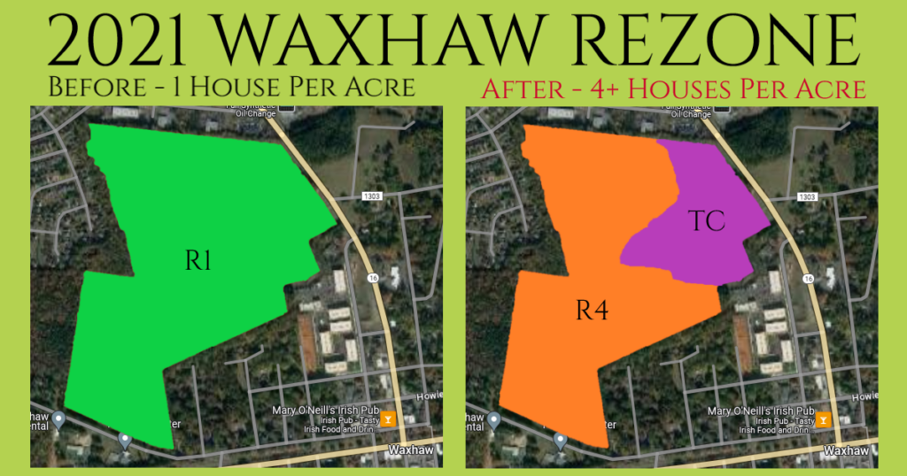
If you’d like to compare, click here for the old zoning map. For the new zoning map that was adopted, click here and skip to page 397. Skip to page 24 of this document for detailed descriptions of the various types of zoning.
In 2019 this property was annexed into Waxhaw, and the Planning Board recommended R1 zoning which was two and a third acre lots back then. The rationale for recommending the lowest possible zoning was to “preserve the land”. In October, the BOC adopted the R1 zoning. Here’s the video: